3DBuildingsUpdates includedWith every purchase, data updates are now included for one year. Watch our monthly updates here: https://onegeo.co/releases/Sep 9, 2022Sep 9, 2022
3DBuildings3dbuildings » ONEGEO3dbuildings will transition into a new company, ONEGEO GmbH. Everything about 3dbuildings will stay the same, from our data to our service.Jul 13, 2022Jul 13, 2022
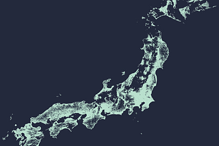
3DBuildings1 Billion Buildings MappedThose who have counted with us last months might have guessed it — we’ve surpassed the 1 billion mark! Our latest addition, buildings from…Feb 15, 2022Feb 15, 2022
3DBuildingsGlobal HeightWe’re happy to announce the first version of 3dbuildings Global Height.Dec 27, 2021Dec 27, 2021
3DBuildingsBuildings? 3dbuildings!OpenStreetMap data is free and available from many providers.Jun 2, 2021Jun 2, 2021
3DBuildings3dbuildings on Amazon AWS MarketplaceOne of the largest marketplaces for data is Amazon Web Services (AWS) Marketplace. Therefore we are pleased to offer 3dbuildings data…Dec 16, 2020Dec 16, 2020
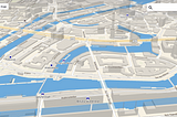
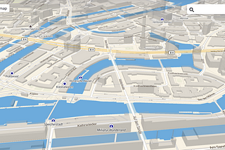
3DBuildingsHow to: Create a 3d buildings view in QGISIn GIS the most common way to get a feeling about a data set and to assess its quality is visual inspection. Artefacts or plausibility…Dec 9, 20201Dec 9, 20201
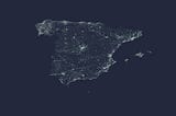
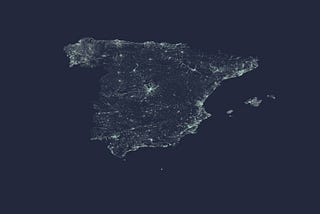
3DBuildingsNew data added: SpainWith the latest updates to our database, we can now offer an incredible 99% coverage for the great nation of España.Dec 1, 2020Dec 1, 2020
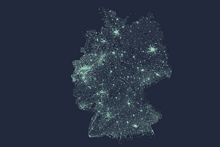
3DBuildingsNew data added: GermanyDeutschland is kind of a big deal when it comes to big data, but that doesn’t mean that it’s easy to work with. Until now.Nov 13, 2020Nov 13, 2020